
Mayon Volcano Volcanic Ash Advisory: ERUPTION AT 20260926/1413Z VA CLD UNKNOWN REPORTED OBS VA DTG: 26/1420Z
Saturday, Sep 26, 2026 14:45 | 12 hours ago | By: VN
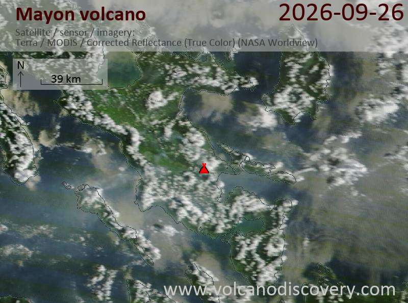
Satellite image of Mayon volcano on 26 Sep 2026
The Volcanic Ash Advisory Center (VAAC) Tokyo issued the following bulletin.
Original VAAC bulletin:
FVFE01 at 14:35 UTC, 26/09/26 from RJTD
VA ADVISORY
DTG: 20260926/1435Z
VAAC: TOKYO
VOLCANO: MAYON 273030
PSN: N1315 E12341
AREA: PHILIPPINES
SOURCE ELEV: 2462M AMSL
ADVISORY NR: 2026/796
INFO SOURCE: HIMAWARI-9 PHIVOLCS
ERUPTION DETAILS: ERUPTION AT 20260926/1413Z VA CLD UNKNOWN REPORTED
OBS VA DTG: 26/1420Z
OBS VA CLD: VA NOT IDENTIFIABLE FM SATELLITE DATA WIND FL180 090/1KT
FCST VA CLD +6 HR: NOT AVBL
FCST VA CLD +12 HR: NOT AVBL
FCST VA CLD +18 HR: NOT AVBL
RMK: WE WILL ISSUE FURTHER ADVISORY IF VA IS DETECTED IN SATELLITE
IMAGERY.
NXT ADVISORY: NO FURTHER ADVISORIES=
Key terms explained Volcanic ash advisory A volcanic ash advisory provides information about airborne ash and its effects on aviation.
Volcanic ash Volcanic ash consists of tiny rock, glass and crystal fragments, typically produced during an explosive volcanic eruption or other processes such as rock avalanches.
VAAC Volcanic Ash Advisory Centers (VAAC) are research centres who monitor volcanic ash clouds in real time. Each time, a volcano erupts a significant ash cloud, short reports are issued and transmitted directly to air control centres. The 9 VAAC are located in London, Toulouse, Tokyo, Darwin, Anchorage, Washington, Montreal and Buenos Aireas and collectively cover most of the globe.
Previous news
Mayon Volcanic Ash Advisory: ash plume height unknown as of 23 Sep 2026, 02:20 UTC
Wednesday, Sep 23, 2026 | 4 days ago · VN

An eruption was reported at Mayon at 02:12 UTC on 23 September 2026, but the ash cloud height was un… Open article
Mayon Volcanic Ash Advisory: ash plume height unknown as of 21 Sep 2026, 11:40 UTC
Monday, Sep 21, 2026 | 5 days ago · VN

An eruption was reported at Mayon on 21 September 2026 at 11:47 UTC, but the ash cloud height was un… Open article
Mayon volcano (Philippines) remains at Alert Level 2 after brief ash emission
Wednesday, Sep 16, 2026 | 10 days ago
Mayon Volcano remained under Alert Level 2, described as decreased unrest, on September 16, 2026, according to the Philippine Institute of Volcanology and Seismology.
PHIVOLCS recorded 17 volcanic earthquakes and one ash-emission event lasting 46 seconds during the latest 24-hour observation period. A moderate plume rose 750 meters above the crater and drifted southwest and west-southwest. Crater g…Read more Open article
Mayon Volcanic Ash Advisory: ash cloud reported as of 15 Sep 2026, 14:00 UTC
Tuesday, Sep 15, 2026 | 11 days ago · VN

An eruption was reported at Mayon, but the ash cloud was not identifiable in satellite data as of 15… Open article
Mayon Volcano Volcanic Ash Advisory: ERUPTION AT 20260914/0408Z VA CLD UNKNOWN REPORTED OBS VA DTG: 14/0410Z
Monday, Sep 14, 2026 | 12 days ago · VN

The Volcanic Ash Advisory Center (VAAC) Tokyo issued the following bulletin.
Original VAAC bulletin:
F… Open article
Mayon Volcanic Ash Advisory
Saturday, Sep 12, 2026 | 14 days ago · VN

An eruption was reported at Mayon at 21:52 UTC on 12 September 2026, but as of 21:50 UTC, volcanic a… Open article
Mayon volcano
Stratovolcano
2,462 m / 8,077 ft
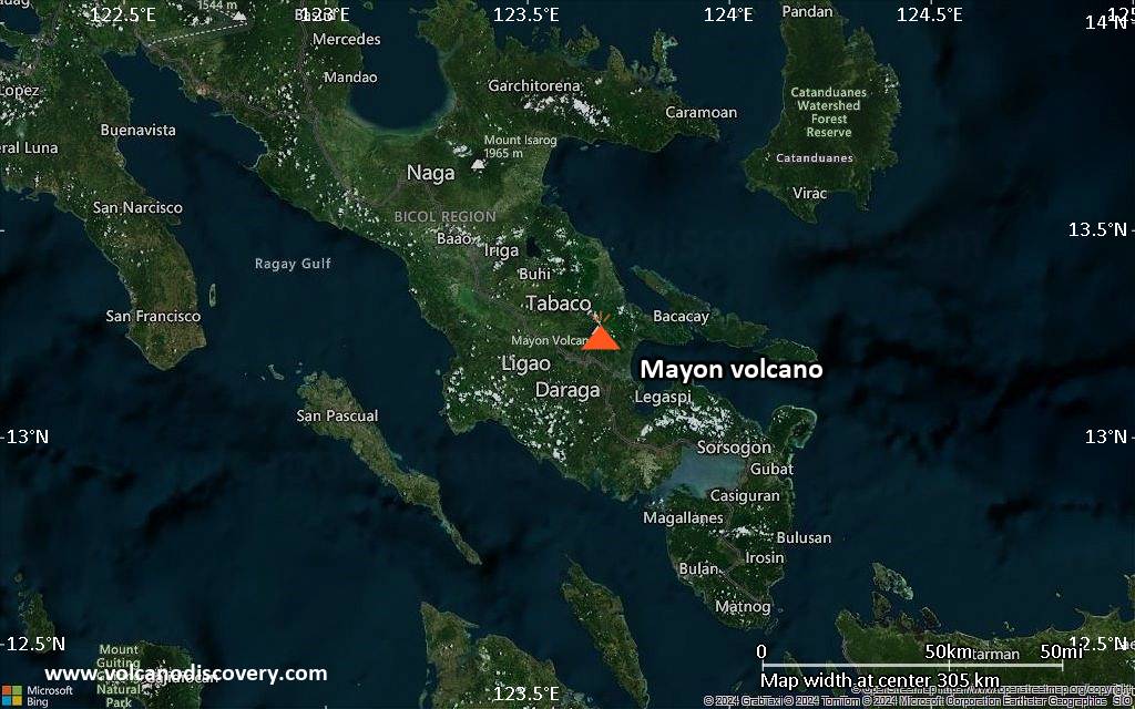
Luzon Island, Philippines, 13.26°N / 123.69°E
 Current status: erupting (4 out of 5)
Mayon webcams / live data | News/Updates | Earthquakes | Accommodation nearby
Show all Eruptions BC: 3100 BC+-300
First millennium: 470 AD+-75
17th century: 1616 (19 Feb - 23 Feb)
18th century: 1766 (20 Jul - 25 Jul), 1767 (24 Oct), 1800 (30 Oct - 31 Oct)
19th century: (1811 5 Oct - 6 Oct), 1814 (1 Feb - 15 Feb or later), 1827 (27 Jun)- 1828 (28 Feb), 1834 (2 Jul+-182 d)- 1835 (16 May+-15 d), 1839 (2 Jul+-182 d), 1845 (20 Jan+-1 d - 30 Jan+-1 d), 1846 (11 May), 1851 (26 May - 16 Jun+-15 d), 1853 (13 Jul - 26 Aug), 1855 (22 Mar), 1857 (2 Jul+-182 d), 1858 (16 Jan+-15 d - 16 Dec+-15 d), 1859 (2 Jul+-182 d), 1860 (2 Jul+-182 d), 1861 (2 Jul+-182 d), 1862 (2 Jul+-182 d), (1863 30 May), 1868 (17 Dec), 1871 (8 Dec)- 1872 (16 Jan+-15 d), 1872 (5 Sep - 9 Sep), 1873 (20 Jun - 22 Jul), 1876 (16 Apr+-15 d), 1876 (26 Nov), 1881 (6 Jul)- 1882 (16 Aug+-15 d), 1885 (21 Nov - 2 Dec), 1886 (8 Jul)- 1887 (10 Mar), 1888 (15 Dec), 1890 (10 Sep - 30 Sep), 1891 (3 Oct)- 1892 (29 Feb), 1893 (3 Oct? - 31 Oct), 1895 (20 Jul - 26 Nov), 1896 (31 Aug - 27 Sep), 1897 (23 May or before - 23 Jul), 1900 (1 Mar - 6 Mar)
20th century: 1902 (2 Jul+-182 d), 1928 (16 Jan?+-15 d - 26 Aug+-5 d), 1938 (5 Jun), 1939 (21 Aug), 1941 (13 Sep), 1943 (2 Jul+-182 d), 1947 (8 Jan - 16 Feb+-15 d), 1968 (21 Apr - 20 May), 1978 (7 Mar - 16 Sep?+-15 d), 1984 (9 Sep - 6 Oct), 1993 (2 Feb - 4 Apr), 1999 (22 Jun)- 2000 (19 Mar)
2000 (16 Jul - 31 Aug), 2001 (8 Jan - 8 Aug), 2002 (11 Oct), 2003 (17 Mar - 14 May), (2003 8 Oct - 11 Oct?), 2004 (3 Jun - 12 Sep?), 2005 (17 Aug or before), 2006 (21 Feb - 23 Feb), 2006 (13 Jul - 1 Oct), 2008 (10 Aug), 2009 (15 Sep)- 2010 (1 Jan?) 2013 (7 May), 2014 (12 Aug - 19 Oct), 2018 (13 Jan)- 2019 (31 Jul+-30 d)
2022 (6 Jun - 7 Oct), 2023 (27 Apr+-2 d)- 2024 (4 Feb), 2024 (30 May - 18 Jul), 2026 (6 Jan - 25 Mar) - ongoing
Typical eruption style
Explosive.
More on VolcanoDiscovery

Our second calendar with 13 high-quality volcano images, for the year 2013!

Lists and maps of earthquakes in the world in near real time. Country lists, earthquake archive, and I-felt-it reports.

Get current updates on the current activity on Iceland's Reykjanes Peninsula including its most recent eruptions in 2021, 2022, 2023!

This beautiful stratovolcano in western Mexico is one of the most active volcanoes on the American continents. It is known for its often spectacular explosions and sometimes glowing avalanches.

Why is there advertising on this site?
Support Us – Help Us Enhance Our Services!
We’re passionate about delivering the latest volcano and earthquake data from around the globe — just for you.
However, maintaining our website and free apps requires significant time, effort, and resources.
Your support helps us expand our hardware and software capabilities and empowers our dedicated editorial team.
Our mission is to provide uninterrupted, real-time updates whenever an earthquake strikes or a volcano erupts — and your donations make this possible. Every contribution, big or small, is deeply appreciated.
If you find our information valuable and want to help us add new features, create compelling content, and improve our technology, please consider making a donation:
Donate with PayPal:

Planned Features:
- Improved multilingual support
- Tsunami alerts
- Faster responsiveness
Thanks to your past donations, we have recently added:
- Design upgrades
- Detailed earthquake statistics
- Additional seismic data sources
Download the Volcanoes & Earthquakes app to stay among the first to receive the fastest seismic and volcano alerts online:
Thank you for being part of our mission!
Tooltip
Sources: VolcanoDiscovery / VolcanoAdventures and other sources as noted.
Use of material: Most text and images on our websites are owned by us. Re-use is generally not permitted without authorization. Contact us for licensing rights.
Volcanoes & Earthquakes

Volcanoes | Earthquakes | Photos | Volcano News | | Shop | App
Adventure & Study Travel

Tours & Dates | FAQ | About us
Get our newsletter!
Company info
Contact | Legal info | Terms & conditions
Follow us





VolcanoDiscovery GmbH, Germany, Reg. nr.: HRB 103744, EU Tax Id: DE 297 465 123 owned and created by
Dr. Tom Pfeiffer, volcanologist, volcano photographer, tour organizer member of

IAVCEI

Volcanological Society

Ecotourism Greece

Insured by R+V
VolcanoDiscovery © 2004-2026All Rights Reserved | Privacy - Cookie Settings


