
Late storms push Tucson monsoon into barely above-average territory
Tucson managed to claw its way to a slightly above-average monsoon this year, and all it took was some last-minute help from a hurricane.
The remnants of Pacific cyclone Polo added almost four-tenths of an inch of rain to the Old Pueblo’s monsoon total early this week, pushing it just past the 30-year average of 5.69 inches as the season came to a close on Wednesday.
The official weather station at Tucson International Airport recorded 5.76 inches of rainfall from June 15 through the end of September, more than double the 2.82 inches of monsoon rain that was logged there last year.
Long story short, according to meteorologist Glenn Lader with the National Weather Service in Tucson: “We were a smidge above normal.”
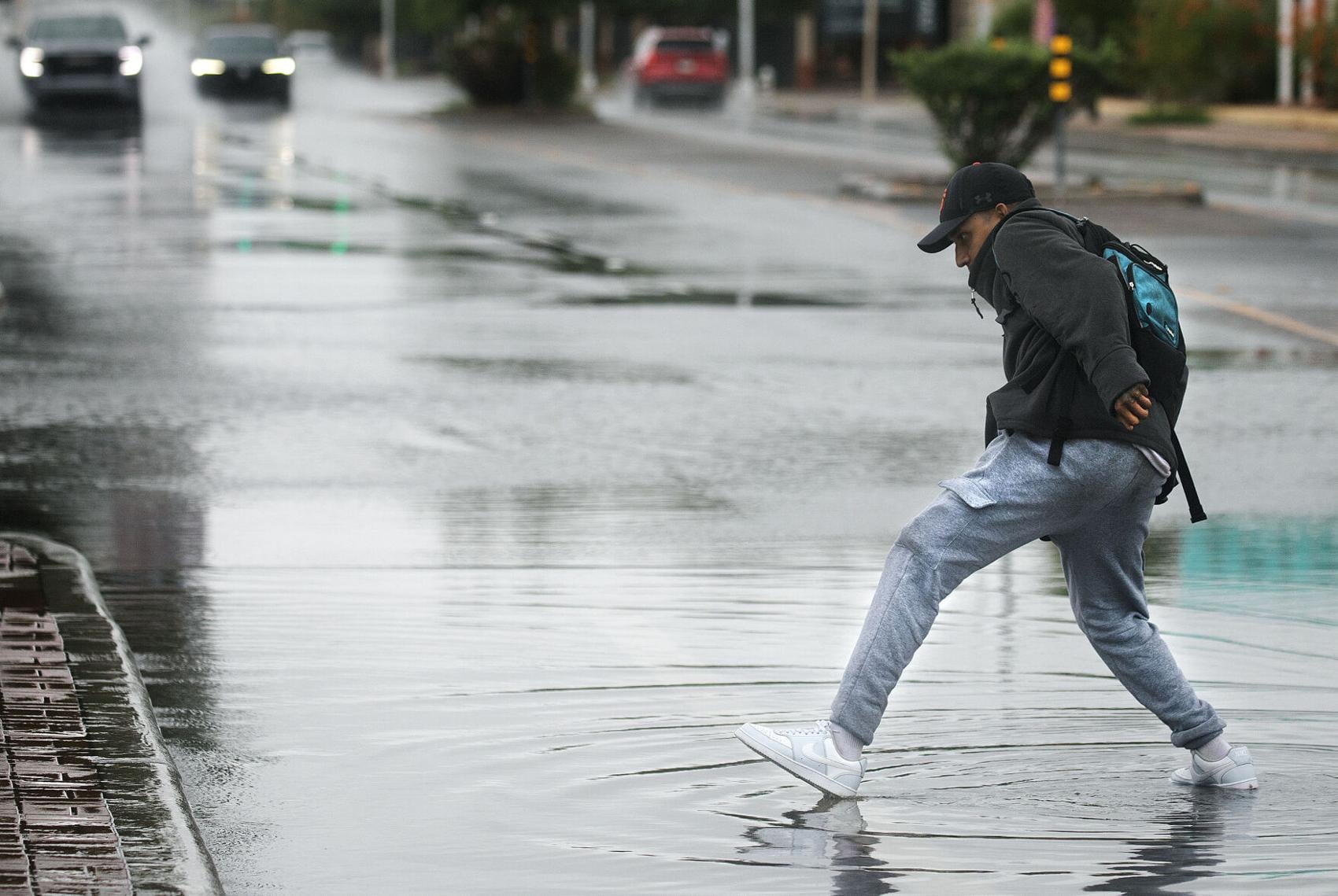
A man lightly wades through a large puddle at North Stone Avenue and East First Street after a morning thunderstorm rolled over Tucson on September 29, 2026.
Mamta Popat, Arizona Daily Star
As a result, 2026 will land somewhere in the middle of the pack on the list of monsoon seasons dating back to 1895. Tucson’s wettest monsoon on record was in 1964, when a whopping 13.84 inches fell, while 1924 still ranks as the driest, with just 1.59 inches. The closest we have come to breaking those records in recent history was 12.79 inches in 2021 and 1.62 inches in 2020, respectively.
But monsoon 2026 felt anything but average to you, it’s probably because of what side of town you live on.
High variability is a signature feature of every Southwestern monsoon season, “but this year that was especially true,” Lader said. “You’re talking (about a range of) two to three inches to 15 inches plus, just across different parts of metro Tucson.”
In that respect, this week’s storms were a microcosm of the season as a whole. Lader said the moisture from Polo combined with a weather system moving through the area to produce widespread but “highly variable” rainfall across the region.
“Every area got something,” he said, but totals on Tuesday and Wednesday ranged widely from more than two inches in some parts of Tucson to less than two-tenths of an inch in others.
Nearly 5 inches fell on parts of Mount Lemmon, sending water rushing down Sabino Creek and the Cañada del Oro Wash, while steady rain in the Tucson Mountains filled Brawley Wash and shut down roads in and around the western district of Saguaro National Park.
“That’s kind of the nature of the beast. The monsoon is highly localized,” Lader said. “That’s just the way the cookie crumbles.”
The season was even soggier in places like Nogales, Picacho Peak, Safford, Sierra Vista and Willcox, all of which enjoyed well above-average rainfall this monsoon.
And Lader said Southern Arizona could see continued wet weather into October and beyond, thanks to an unusually strong El Niño event now underway in the tropical Pacific.
The semi-cyclical climate phenomenon often results in wetter winters in the desert Southwest, as the Pacific jet stream migrates south from its usual position. It’s also known to spin up tropical storms like Polo that can funnel more moisture into our area.
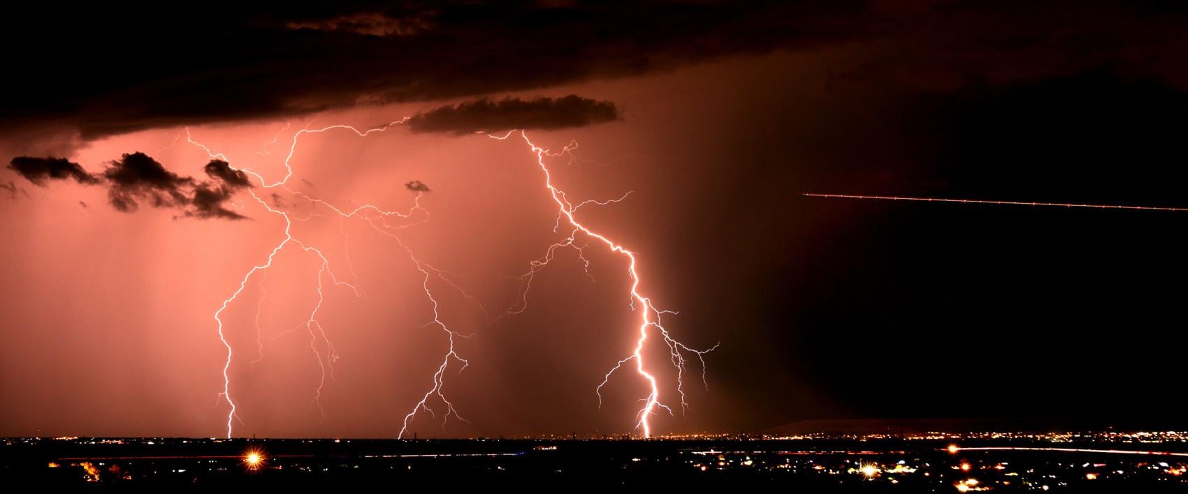
An aircraft flies towards several bolts of lightning striking down as a monsoon storm rolls through southeast of Tucson on July 18, 2026.
Kelly Presnell, Arizona Daily Star
According to Lader’s own analysis, nine of the last 11 moderate to strong El Niño events over the past 75 years coincided with above-average precipitation from November through April in Southern Arizona.
The National Oceanic and Atmospheric Administration's Climate Prediction Center has said this year’s El Niño is likely to be the strongest since recordkeeping began in 1950.
Wednesday marked the end of the first monsoon season in decades with no local weather balloon readings to back up the forecasts for Tucson and surrounding areas.
The National Weather Service office on the University of Arizona campus stopped launching weather balloons from the rooftop of its building at Sixth Street and Park Avenue in late January due to apparent infrastructure problems that prevented the safe delivery of helium to the site.
Lader said the issue should be resolved “hopefully soon,” so that the twice-daily sounding balloon flights can resume by the end of October.
Experts say the lack of daily readings from the upper atmosphere has weakened the accuracy of forecasts, especially in summertime when the weather is at its most volatile.
U of A research scientist Patrick Bunn and long-time meteorologist Pat Holbrook publish a daily online recap and forecast discussion throughout the summer that has been called “the best monsoon tracker in Arizona.” But since the balloon launches stopped, Bunn said, the sophisticated computer model they use hasn’t consistently reached the correct conclusions in the absence of that data.
“It’s caused us to lose a bit of confidence in what it’s saying,” he said. “It’s a really difficult situation. The thing we really need as forecasters is to have confidence in the models that we use.”
Holbrook has been forecasting the monsoon in the Southwest off and on for about 20 years, but this summer “was probably the hardest, because sometimes the model had no idea,” he said. “We had a couple of days when we were quite surprised by what was happening.”
In late August, for example, their computer projections fell into a brief pattern of being a day off when it came to predicting the up-and-down cycle of when monsoon storm activity would occur, Bunn said. “The modeling was kind of struggling to catch up to reality.”
He said the local weather service office has missed stuff, too.
“The forecasters at the NWS have been doing the best that they can,” Bunn said. “The models are only as good as the data you feed into them.”
Contact reporter Henry Brean at hbrean@tucson.com. On X: @RefriedBrean
Subscribe to stay connected to Tucson. A subscription helps you access more of the local stories that keep you connected to the community.


